

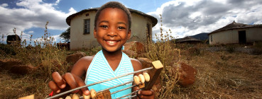
IMPROVING LIVES THROUGH DATA ECOSYSTEMS
Blue Crane Route
Quick Fact
According to 2011 census results Blue Crane Route Local Municipality has a total population estimated at 36 002 persons.
Blue Crane Route Local Municipal area has a number of strategic environment advantages. It contains 97% of natural land covers, is centrally located between three national parks, contains biodiversity of regional and national significance, can boast incredible scenic beauty, and local conditions present a number of opportunities for renewable energy generation on a large scale. However the area faces a number of issues such as higher densities of population primarily concentrated in the three urban centres.
The low agricultural productivity and carrying capacity of much of the land in the municipality, combined with limited access to water for irrigation, has restricted development of the agricultural economy. The remoteness of the urban centres limits growth of business, services and sectors.
| Rank view all | ||
|---|---|---|
| Letsemeng , Free State | 38,628 | 188 |
| Mpofana , KwaZulu-Natal | 38,103 | 189 |
| Siyancuma , Northern Cape | 37,076 | 190 |
| Blue Crane Route , Eastern Cape | 36,002 | 191 |
| Swellendam , Western Cape | 35,916 | 192 |
| Mookgopong , Limpopo | 35,640 | 193 |
| The Big 5 False Bay , KwaZulu-Natal | 35,258 | 194 |
Quick Fact
10,5 aged 20+ had no formal schooling.
According to 2011 census results Blue Crane Route Local Municipality has a total population estimated at 36 002 persons, of which 59,0 % are black African,33,0% are coloured people and the res t are white people, and Indian/Asian. Of those aged 20 years and older 7,6%have completed primary school, 38,1% have some secondary education, 18,9% have completed matric, and 6,8% have some form of higher education. 10,5% of those aged 20 years and older have no form of schooling. Xhosa is the most widely used language in the region at 50,1%, with Afrikaans not far behind at 42,1%. Only 3,3% of the residents have English as their first language.
| Group | Percentage |
|---|---|
| Black African | 59% |
| Coloured | 33% |
| Indian/Asian | 0,3% |
| White | 6,8% |
| Other | 0,8% |
| Age | Males | Females |
|---|---|---|
| 0-4 | 6% | 5% |
| 5-9 | 4,8% | 4,8% |
| 10-14 | 4,6% | 4,1% |
| 15-19 | 4,3% | 4,5% |
| 20-24 | 4% | 4% |
| 25-29 | 3,9% | 3,8% |
| 30-34 | 3,2% | 3,2% |
| 35-39 | 3,3% | 3,5% |
| 40-44 | 2,9% | 3,3% |
| 45-49 | 2,8% | 2,8% |
| 50-54 | 2,7% | 2,9% |
| 55-59 | 2,1% | 2,5% |
| 60-64 | 1,6% | 2% |
| 65-69 | 1,1% | 1,4% |
| 70-74 | 0,9% | 1,3% |
| 75-79 | 0,4% | 0,7% |
| 80-84 | 0,2% | 0,4% |
| 85+ | 0,2% | 0,3% |
| Language | Percentage |
|---|---|
| Afrikaans | 42,2% |
| English | 3,3% |
| IsiNdebele | 0,1% |
| IsiXhosa | 50,1% |
| IsiZulu | 0,2% |
| Sepedi | 0,1% |
| Sesotho | 0,2% |
| Setswana | 0,3% |
| Sign Language | 0,3% |
| SiSwati | 0,1% |
| Tshivenda | 0% |
| Xitsonga | 0,1% |
| Other | 0.7% |
| Not Applicable | 2,3% |
| Group | Percentage |
|---|---|
| Married | 22,7% |
| Living together like married partners | 9,3% |
| Never married | 62,7% |
| Widower/Widow | 4,1% |
| Separated | 0,5% |
| Divorced | 0,8% |
| Group | Percentage |
|---|---|
| No Schooling | 2,7% |
| Some Primary | 48,4% |
| Completed Primary | 8% |
| Some Secondary | 29,3% |
| Completed Secondary | 8,9% |
| Higher Education | 1,2% |
| Not Applicable | 1,5% |
| Sex | Percentage |
|---|---|
| Female | 50,9% |
| Male | 49,1% |
Quick Fact
86,9% had access to electricity
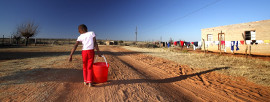
There are 9 761 households in the municipality with an average household size of 3,5 persons per household. There are 51,5%of households that have access to piped water inside dwelling/institution;40,0% have water in their yard and 3,5% of households do not have access piped water. Households that have access to electricity make up 86,9%.
| Area | Percentage |
|---|---|
| Urban | 80,7% |
| Tribal/Traditional | 0% |
| Farm | 19,3% |
| Item | Yes | No |
|---|---|---|
| Cellphone | 69,6% | 30,4% |
| Computer | 12,9% | 87,1% |
| Television | 75,1% | 24,9% |
| Satellite Television | 19,2% | 80,8% |
| Radio | 66,7% | 33,3% |
| Landline / Telephone | 14,2% | 85,8% |
| Motor Car | 20,6% | 79,4% |
| Refrigerator | 67,3% | 32,7% |
| Electric / Gas-Stove | 80,3% | 19,7% |
| Energy Source | Cooking | Heating | Lighting |
|---|---|---|---|
| Electricity | 82,2% | 59,2% | 86,9% |
| Gas | 2,4% | 1,3% | 0,2% |
| Paraffin | 6,9% | 9,1% | 3,1% |
| Solar | 0,2% | 0,2% | 0,4% |
| Candles | 0% | 0% | 9% |
| Wood | 7,6% | 19,7% | 0% |
| Coal | 0,3% | 0,8% | 0% |
| Animal Dung | 0% | 0% | 0% |
| Other | 0,1% | 0% | 0% |
| None | 0,3% | 9,6% | 0,4% |
| Access | Percentage |
|---|---|
| From Home | 5,9% |
| From Cellphone | 13,9% |
| From Work | 2,4% |
| From Elsewhere | 3,9% |
| No Access | 73,9% |
| Tenure Status | Percentage |
|---|---|
| Rented | 26,1% |
| Owned and fully paid off | 46% |
| Owned but not yet paid off | 6,3% |
| Occupied rent free | 18% |
| Other | 3,6% |
| Source of water | Percentage |
|---|---|
| Regional/Local water scheme (operated by municipality or other water services provider) | 80,2% |
| Borehole | 9,8% |
| Spring | 0,3% |
| Rain water tank | 2,8% |
| Dam/Pool/Stagnant water | 3,2% |
| River/Stream | 0,5% |
| Water vendor | 0,3% |
| Water tanker | 1,4% |
| Other | 1,4% |
| Toilet Facility | Percentage |
|---|---|
| None | 6,3% |
| Flush toilet (connected to sewerage system) | 80,5% |
| Flush toilet (with septic tank) | 4% |
| Chemical toilet | 0,3% |
| Pit toilet with ventilation | 0,9% |
| Pit toilet without ventilation | 3,4% |
| Bucket toilet | 2,8% |
| Other | 1,8% |
| Refuse Disposal | Percentage |
|---|---|
| Removed by local authority/private company at least once a week | 80,3% |
| Removed by local authority/private company less often | 0,5% |
| Communal refuse dump | 0,8% |
| Own refuse dump | 14,8% |
| No rubbish disposal | 2% |
| Other | 1,5% |
| Refuse Disposal | Percentage |
|---|---|
| Removed by local authority/private company at least once a week | 80,3% |
| Removed by local authority/private company less often | 0,5% |
| Communal refuse dump | 0,8% |
| Own refuse dump | 14,8% |
| No rubbish disposal | 2% |
| Other | 1,5% |
Quick Fact
30,7% are unemployed
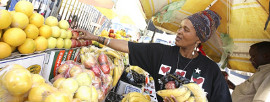
There is 10 734 people who are economically active (employed or unemployed but looking for work); of these 30,7 % are unemployed. Of the 4 884 economically active youth (15–35 years) in the area, 40,0 % are unemployed.
| Employment Status | Number |
|---|---|
| Employed | 7434 |
| Unemployed | 3300 |
| Discouraged Work Seeker | 1294 |
| Not Economically Active | 10935 |
| Income | Percentage |
|---|---|
| None income | 12,2% |
| R1 - R4,800 | 4,6% |
| R4,801 - R9,600 | 7,1% |
| R9,601 - R19,600 | 24,8% |
| R19,601 - R38,200 | 24% |
| R38,201 - R76,4000 | 12,2% |
| R76,401 - R153,800 | 7,1% |
| R153,801 - R307,600 | 4,9% |
| R307,601 - R614,400 | 2,2% |
| R614,001 - R1,228,800 | 0,5% |
| R1,228,801 - R2,457,600 | 0,2% |
| R2,457,601+ | 0,2% |
| Agricultural households | |
|---|---|
| Type of specific activity | Number |
| Livestock production | 665 |
| Poultry production | 686 |
| Vegetable production | 570 |
| Production of other crops | 347 |
| Other | 347 |
**An agricultural household may engage in more than one agricultural activity
| Agricultural households | |
|---|---|
| Type of activity | Number |
| Crops only | 531 |
| Animals only | 873 |
| Mixed farming | 274 |
| Other | 55 |
**An agricultural household may not fall under more than one agricultural activity
| Income category of agricultural households | |
|---|---|
| Annual income category of agricultural household heads | Number |
| No income | 326 |
| R1-R4 800 | 43 |
| R4 801-R38 400 | 980 |
| R38 401-R307 200 | 280 |
| R307 201+ | 50 |
| Unspecified | 70 |
| Agricultural households municipal data per province |
|---|
| Western Cape (download) |
| Eastern Cape (download) |
| Northern Cape (download) |
| Free State (download) |
| KwaZulu-Natal (download) |
| North West (download) |
| Gauteng (download) |
| Mpumalanga (download) |
| Limpopo (download) |
**Please note that each province contains twenty five tables
Place names
Key Statistics 2011
| Total population | 36,002 |
| Young (0-14) | 29,2% |
| Working Age (15-64) | 63,8% |
| Elderly (65+) | 7% |
| Dependency ratio | 56,8 |
| Sex ratio | 96,5 |
| Growth rate | 0,17% (2001-2011) |
| Population density | 3 persons/km2 |
| Unemployment rate | 30,7% |
| Youth unemployment rate | 40% |
| No schooling aged 20+ | 10,5% |
| Higher education aged 20+ | 6,3% |
| Matric aged 20+ | 18,9% |
| Number of households | 9,761 |
| Number of Agricultural households | 1,733 |
| Average household size | 3,5 |
| Female headed households | 39,3% |
| Formal dwellings | 95,9% |
| Housing owned/paying off | 52,2% |
| Flush toilet connected to sewerage | 80,5% |
| Weekly refuse removal | 80,3% |
| Piped water inside dwelling | 51,4% |
| Electricity for lighting | 86,9% |
Key Statistics 2001
| Total population | 35,407 |
| Young (0-14) | 29,4% |
| Working Age (15-64) | 63,8% |
| Elderly (65+) | 6,3% |
| Dependency ratio | 55,7% |
| Sex ratio | 92,7 |
| Growth rate | 0,47% (2001-2011) |
| Unemployment rate | 40% |
| Youth unemployment rate | 49,7% |
| No schooling aged 20+ | 19,8% |
| Higher education aged 20+ | 5,3% |
| Matric aged 20+ | 11,7% |
| Number of households | 9,595 |
| Average household size | 3,6 |
| Female headed households | 32,4% |
| Formal dwellings | 90% |
| Housing owned/paying off | 36% |
| Flush toilet connected to sewerage | 46,3% |
| Weekly refuse removal | 65,9% |
| Piped water inside dwelling | 24,7% |
| Electricity for lighting | 65,1% |